Aspect Land & Hydrographic Surveys Ltd is now apart of SOCOTEC
Aspect Land & Hydrographic Surveys Ltd has officially become part of SOCOTEC UK & Ireland. This exciting development brings together Aspect’s specialist land, hydrographic and geospatial surveying expertise with SOCOTEC’s broad technical capabilities, enabling us to deliver even more comprehensive solutions to our clients across the UK & Ireland.
While the name may have changed, the expertise, innovation, and commitment to quality that defined Aspect Land & Hydrographic Surveys remain at the heart of what we do, now strengthened by the resources, scale, and multidisciplinary services of SOCOTEC.
What This Means for You
As part of SOCOTEC, the Aspect surveying team continues to provide the same trusted services and technical expertise clients rely on, now enhanced by access to SOCOTEC’s wider network of specialists and integrated solutions across the built and natural environment.
You can now benefit from:
A larger team of industry-leading experts and technical consultants
Nationwide project support backed by SOCOTEC’s multidisciplinary capabilities

Aspect Land & Hydrographics Ltd is now apart of SOCOTEC
About Aspect
Aspect Land & Hydrographics Ltd History
Founded in 1996, Aspect Land & Hydrographic Surveys Ltd quickly established itself as one of the UK’s leading independent surveying companies, specialising in hydrographic, geophysical, and land survey services.
From its early years, the company built a reputation for delivering high-quality surveying solutions for projects across marine, infrastructure, construction, and environmental sectors. By combining experienced survey professionals with investment in advanced technology, Aspect developed a strong track record of delivering accurate, reliable survey data for complex and challenging environments.
Over the years, the company expanded its capabilities to include hydrographic and bathymetric surveys, geophysical investigations, UAV and LiDAR mapping, and advanced geospatial data processing. This breadth of expertise enabled Aspect to support a wide range of projects including ports and harbours, offshore energy developments, coastal monitoring, infrastructure planning, and environmental studies.
Aspect became known for delivering tailored survey solutions that combine technical precision with practical insight, helping clients make informed decisions at every stage of their projects.
Rebranding & Expansion
SOCOTEC Strengthens Marine Survey Offering with Rebrand of Aspect and Liverpool Expansion
SOCOTEC Land & Hydrographic Surveys, a leading coastal marine survey company has opened a new base in Liverpool, extending its operations from its headquarters in Irvine, Scotland.
In establishing a presence in Merseyside, this strategic decision will enable SOCOTEC Land & Hydrographic Surveys to deliver its services to clients throughout England, building on its already strong reputation within Scotland and removing geographical perceptions that may have previously limited opportunities south of the border.
Where it began
SOCOTEC Acquires Aspect Land & Hydrographic Surveys Ltd
SOCOTEC UK strengthens its offering within the specialist surveying area with the acquisition of leading independent coastal surveying company, Aspect Land & Hydrographic Surveys Ltd.
The acquisition further enhances SOCOTEC UK’s existing land-based surveying capabilities, enabling access to a growing and specialist surveying market with strong opportunities for local expansion.
Our Service Line:
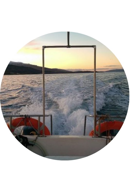
Reliable offshore mapping and underwater survey solutions.
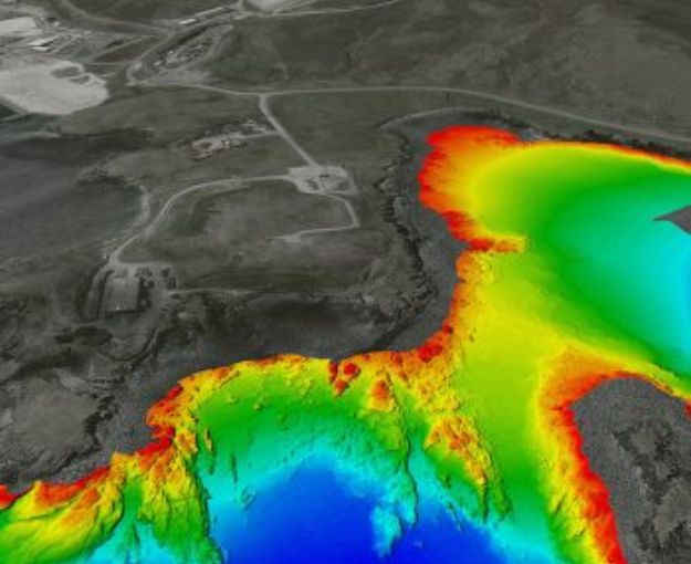
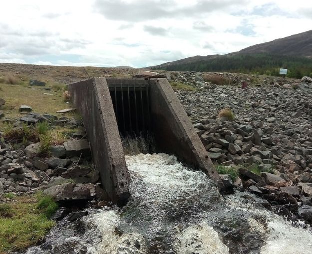
Bathymetry
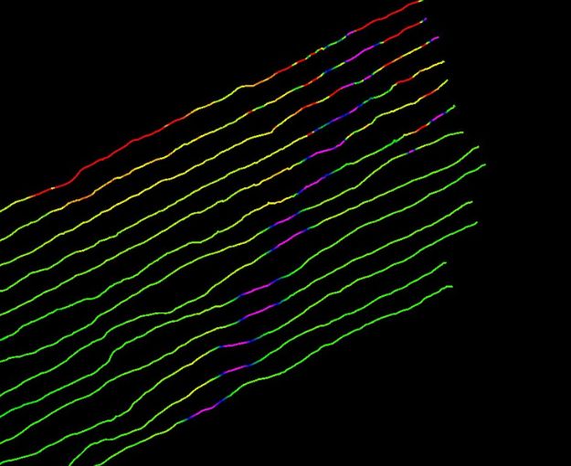
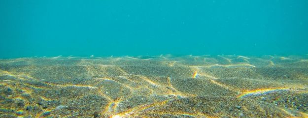
Bathymetry is the measurement and mapping of underwater topography - essentially the underwater equivalent of land surveying. Using sonar technology, we collect water depth data to produce charts, profiles, and 3D models of the seabed, riverbed, lakes, reservoirs, and other water bodies.
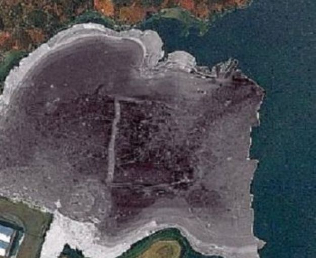
Side-scan Sonar
Side-scan sonar is a sophisticated acoustic imaging technology that creates detailed representations of the seafloor regardless of water clarity.
Sub Bottom Profiling
Sub-bottom profiling is a specialised geophysical survey technique that produces detailed images of the sub-bottom sediment and rock layers beneath the seafloor.
Magnetometer Survey
A magnetometer survey is a specialised geophysical survey technique that measures variations in the Earth's magnetic field to detect and map anthropogenic and geological features across ground, marine, and airborne environments.
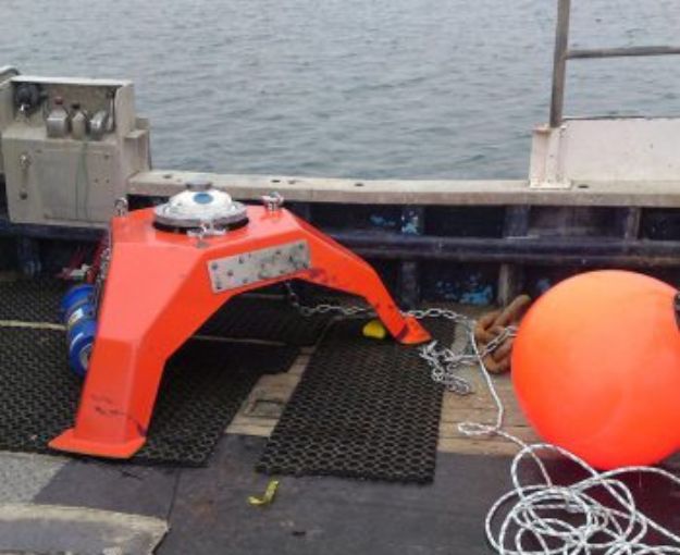
ADCP & Current Monitoring
Acoustic Doppler Current Profilers (ADCPs) are sophisticated hydroacoustic instruments that measure water current velocities throughout the water column using sound wave reflections.
Tidal Analysis & Predictions
tidal analysis provides essential hydrographic data through harmonic analysis of water level measurements captured over thirty or more days.
Water Column Analysis
We deliver a comprehensive water column analysis services using advanced monitoring technologies including fixed and towed sensors, multi-parameter sondes, and specialist profiling systems.
Reservoir Modelling
Reservoir capacity modelling combines bathymetric and topographic survey data to provide an accurate picture of reservoir storage capacity.
All Hydrographic & Oceanographic Services
Coastal and marine environmental survey support
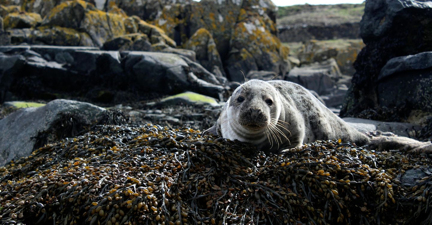
Marine Mammal Observation
Marine mammal observation services are delivered by JNCC qualified MMOs with direct offshore survey experience, enabling informed decision-making that protects marine life while avoiding unnecessary disruption to survey operations.
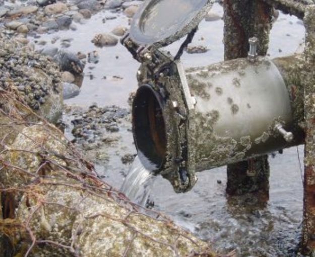
Dye Tracing & Drogue Tracking
Tracking and tracing tidal, river and coastal water flows using fluorescent dyes and surface drogues provides critical information on current behaviour and dispersion characteristics.

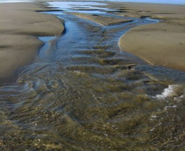
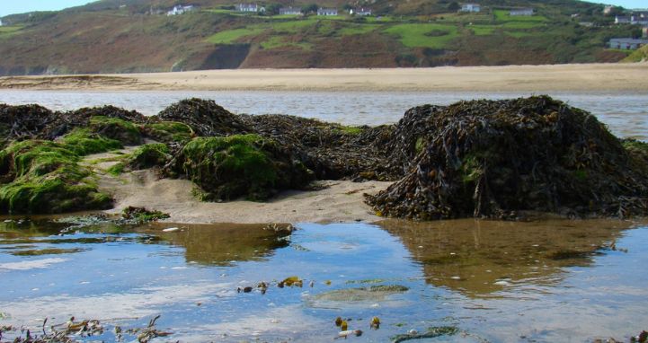
Beach Erosion Studies
We have delivered littoral surveys and beach erosion studies for many years, often through repeat surveys that build detailed datasets showing long-term shoreline change and sediment movement.
ROV Services
Detailed seabed assessment and underwater survey solutions.
Seabed Sampling, reports & Geomorphology
Our sampling techniques are supported by accredited laboratory testing, and our seabed classification workflows utilise industry‑standard acoustic systems combined with ground‑truthing for accuracy.
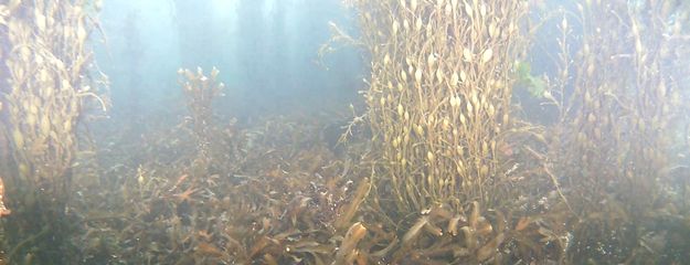
Underwater Imagery
High-resolution stills and video support inspection and reporting, with survey activity guided live by experienced marine surveyors as a practical, cost-effective alternative to diver-led operations where appropriate.
Ports & Harbours Infrastructure Surveys
Ports and harbours infrastructure surveys play a critical role in the safe planning, development, operation and maintenance of marine assets.
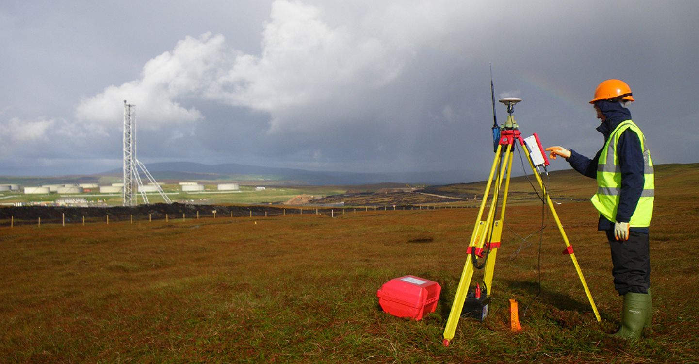
Land & Utility Surveying services provide accurate and innovative solutions for mapping, measuring and analysing land and underground utilities. Our expert team utilises technology and proven methodologies to deliver precise data and insights, enabling informed decision-making for your projects.
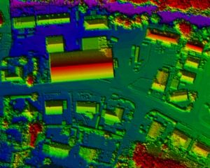
LiDAR Mapping & Surveying
SOCOTEC operates UAV‑mounted, vehicle‑mounted and boat‑mounted LiDAR systems to collect high‑density survey data across the UK.
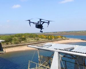
UAS Surveys & Remotely Piloted Aircraft System
Unmanned Aircraft System (UAS) Survey Aircraft commonly referred to as Drones, Unmanned Aerial Vehicles (UAV) or Remotely Piloted Aircraft System (RPAS) form part of a wider operating system that includes the aircraft, control station and data link.
Desktop Surveys
Desktop Utility Searches provide an essential starting point for any project requiring information about Statutory Undertakers' plant owned and operated within a given area.
Building Information Modelling (BIM) Surveys
BIM surveys combine accurate site data capture with digital modelling to produce structured 3D models and survey outputs suitable for Building Information Modelling workflows.
All Land & Utility Services
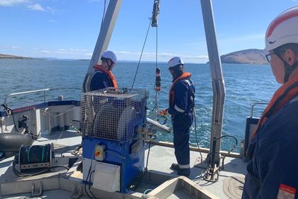
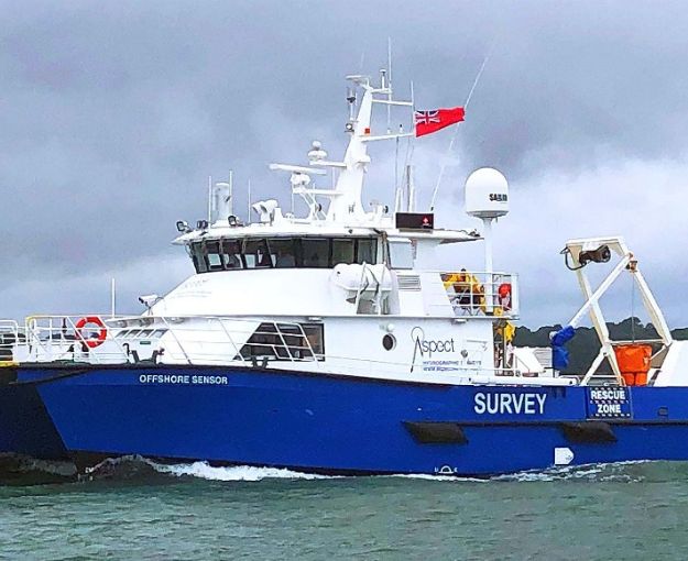
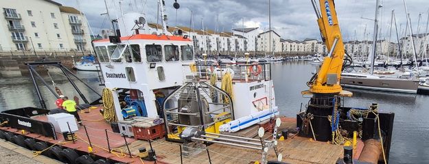
Our Survey Fleet
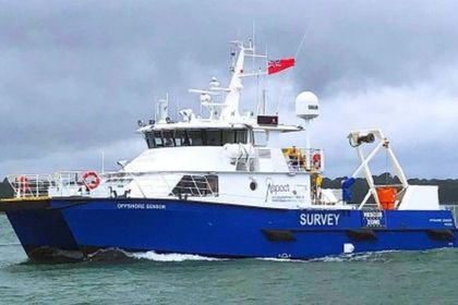
Offshore Sensor
Offshore Sensor is the latest acquisition to Aspect Land & Hydrographic Surveys Ltd’s fleet. The German built vessel, constructed to DNV GL classification and Coded to MCA Cat 1, is a twin hulled catamaran design and measures 22m in length, 8.0m beam and has a shallow 1.85m draught. The boat is powered by 2 x Cat 32 engines, which offer a top speed of 25 knts and a cruising speed of around 20 knts.
The vessel is a safe and stable working platform for any Hydrographic, Geophysical, Geotechnical or Oceanographic project. She is fitted with a large moon pool, over-the-side pole mount, 5m 5T A-Frame and a 5.25T deck crane. The selection of deck machinery allows deployment of a variety of sensors including; Multibeam Echosounders, Geophysical Equipment, ROV’s, Vibrocorers and Towed-wing Magnetometer arrays.
The vessel has a spacious wheelhouse, seating for 12 passengers & crew, survey room, galley, large rear deck with a 10-tonne load capacity and overnight harbour accommodation for 5.
MCA Cat I [150 miles]
Length 22.0m
Beam 8.0m
Draught 1.85m
Proteus
Proteus is a multi-purpose survey vessel ideally suited to working in the challenging offshore environment. Configured to deploy a wide range of Hydrographic, Geophysical, Geotechnical or Oceanographic equipment, she is equipped with central moonpool – able to deploy a variety of sensors including multibeam systems and ADCPs, plus dual deck winches and an ‘A-frame’ for towed equipment such as dual gradiometers for pUXO surveys .
The vessel has a spacious cabin, dedicated survey suite equipped to power laptop computers, on board PC systems and back-up servers as well as a variety of other sensors.
The vessel can comfortably accommodate up to 6 personnel, enabling 24 hour working patterns via crew rotation schedules, where projects & timescales dictate. With ample room in the cabin for personnel and equipment, survey works can continue in adverse weather conditions.
The vessel’s ‘A-frame’ and deck winch can be used for seabed sampling projects, benthic projects, ROV works and ADCP deployment and recovery or other environmental / oceanographic survey disciplines.
MCA Cat II
Length 14.0m
Beam 4.96m
Draught 1.3m
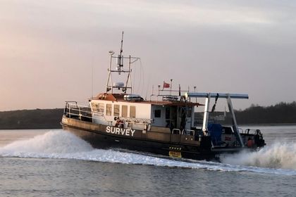
Marine Sensor
Road towable with a small forward cabin, Marine Sensor is easy to deploy from slipway or boat hoist / crane and able to operate a wide variety of sensors. Her hulls and catamaran configuration lend a fast transit speed and give good directional stability resulting in high quality survey data.
MCA Cat III Workboat
Length 6.9m
Beam 2.5m
Draught 0.3m
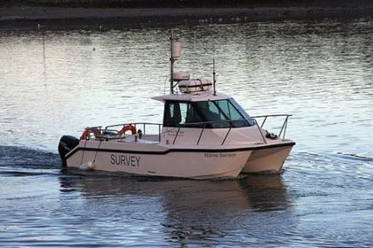
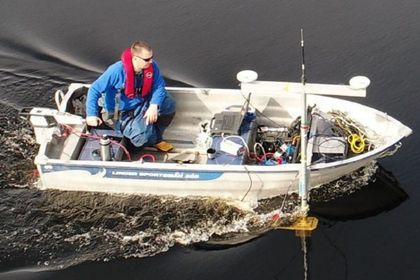
Coastal Sensor
Coastal Sensor is a road transportable 6.1m fibreglass hull SPORTIS SK6100K RIB with enclosed cabin, central console, twin 60Hp outboard engines and spacious aft deck that can be used for inshore bathymetry, oceanographic & environmental projects.
Coastal Sensor’s road trailer has pivoting front and rear roller supports that allow the boat to be launched and recovered in even very shallow water. The boat is able to deploy a variety of sensors from multibeam through to boomer and can access the most confined areas due to high manoeuvrability.
MCA Cat III Workboat
Length 6.1m
Beam 2.0m
Draught 0.3m

Coastal Sensor II
Coastal Sensor II is a road transportable 6.5m fibreglass hull SPORTIS SK6500K RIB with enclosed cabin, central console, twin 60Hp outboard engines and spacious aft deck that can be used for inshore bathymetry, oceanographic & environmental projects.
The vessel is piloted by an RYA qualified coxswain and surveyor and equipped with Trimble RTK GPS equipment and an R2Sonic multibeam echosounder, enabling positional and depth reading to be taken through the course of the works.
MCA Cat III Workboat
Length 6.5m
Beam 2.0m
Draught 0.3m
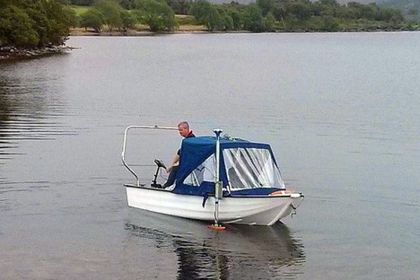
Enviro Sensor
Enviro Sensor is a small aluminium hulled vessel that is used in sheltered waters where access is limited or where the water is considered too shallow to operate the larger vessels.
She can be operated with either petrol outboard engine or electric motor, making her well suited to operate in reservoirs where fossil fuel engines are not permitted. She can be fitted with a variety of sensors including multibeam sonar.
Sheltered Waters
Length 4.0m
Beam 1.5m
Draught 0.2m
Waterway Sensor
Waterway Sensor is a small aluminium hulled vessel that is used in sheltered waters where access is limited or where the water is considered too shallow to operate the larger vessels.
She can be operated with either petrol outboard engine or electric motor, making her well suited to operate in reservoirs where fossil fuel engines are not permitted. She can be fitted with a variety of sensors including multibeam sonar.
Sheltered Waters
Length 3.5m
Beam 1.4m
Draught 0.2m
Littoral Sensor
Littoral Sensor is used to access areas such as mud flats and estuarine environments where fluid mud or sinking sands pose a Health & Safety risk. It is capable of deploying a variety of sensors allowing water sampling, sediment sampling and wide area topographic / hydrographic survey of otherwise inaccessible areas.
Sheltered Waters
Length 3.3m
Beam 1.85m
Draught 0.2m
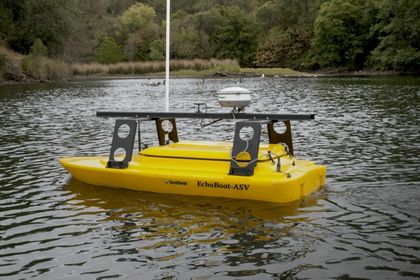
EchoBoat ASV
The EchoBoat ASV is a small, portable autonomously controlled survey platform that is fitted with an R2Sonic 2020 MBES and Applanix INS system. It can be carried and deployed in areas otherwise inaccessible to survey vessels and is able to be positioned using RTK GNSS, or Total Station where there is insufficient satellite coverage.
Remote / Autonomously Controlled
Length 1.8m
Beam 0.8m
Draught 0.1m
Endurance: Up to 8hrs
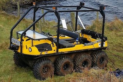
Argocat Avenger 750HDI
The Argocat Avenger 750HDI is an eight wheel vehicle that can transport six people on land and four on water. This vehicle is designed to operate in the most challenging terrain such as mud, snow, ice, sand, marsh and small areas of water. This allows our team to undertake surveys in areas that would otherwise be difficult to access, such as remote lochs and reservoirs.
All Terrain Vehicle
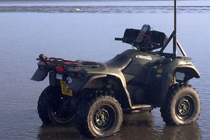
Quad Bike
Our quad bike is used to access and survey areas of various terrains. This vehicle can effectively operate across sand dunes as well as sites consisting of long grass, gorse, heather, scrubland and marsh areas.
4×4 All Terrian Vehicle
Let's Talk
Our specialists provide integrated surveying, testing, inspection, and certification services across the entire asset lifecycle.

Read more of our News & Media

Fire Resistance: Everything you wanted to know but were afraid to ask

Nature Positive Real Estate: Creating Value through Biodiversity
UKTC opens multi-million-pound state-of-the-art second firehall

Infinito Delicias. Building low-carbon spaces for communities to thrive
Mass Data Capture in Modern Surveying