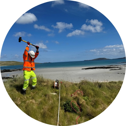
Side-Scan Sonar
Side-scan sonar is a sophisticated acoustic imaging technology that creates detailed representations of the seafloor regardless of water clarity.
This system enables precise identification of seabed objects and geological features using sound energy and signal return analysis. SOCOTEC, formally known as Aspect Land & Hydrographic Surveys Ltd utilises advanced systems, including the EdgeTech 4125 & 4200 Dual Frequency platforms, to deliver high-resolution imagery of the underwater environment for navigational safety, environmental monitoring, and subsea infrastructure inspection.
Side-Scan Sonar
How does side scan sonar work?
Side-scan sonar creates detailed pictures of the seafloor by utilising sound energy and analysing signal returns. This enables rapid and cost-effective mapping of large seabed areas, detecting objects and identifying bathymetric features regardless of water clarity.
Principle of acoustic pulses
Side-scan sonar operates by emitting fan-shaped acoustic pulses down toward the seafloor across a wide angle perpendicular to the path of the sensor. These conical or fan-shaped pulses typically create a wide beam in the vertical plane (40-60°) and a narrow beam in the horizontal plane (0.2-4°). The sound frequencies used vary based on survey objectives—lower frequencies (50-100 kHz) cover larger areas at lower resolution, while higher frequencies (500 kHz to 1 megahertz) record smaller areas with greater detail. When these acoustic pulses encounter the seabed, they reflect back with varying intensities depending on the material properties. Hard surfaces like rock outcrops reflect more sound and produce stronger return signals than softer areas such as sand or mud, creating distinctive patterns of light and dark areas in the resulting imagery.
Main components of a side scan system
A complete side scan sonar system consists of several key components working simultaneously. The primary element is the towfish—a streamlined underwater housing containing the transducer arrays that emit and receive acoustic signals. These transducers convert electrical energy into sound waves and vice versa. The towfish can be towed behind a vessel using a cable system or mounted directly to a vessel's hull. Other essential components include a central processing unit (CPU) for data acquisition, handling systems (winch, tow cable, deck cable & usbl), and positioning equipment. Combined side scan sonar systems often integrate additional capabilities, such as sub-bottom profiling or bathymetric mapping, enhancing survey efficiency by collecting multiple data types simultaneously. The EdgeTech 4125 & 4200 Dual Frequency systems represent a modern example of professional side-scan technology.
Data acquisition & processing workflow
The side-scan data acquisition process begins with proper system configuration and calibration. As the vessel traverses the survey area, the towfish emits acoustic pulses while the system records the intensity and timing of signal returns. This data is transmitted in real-time to the topside computer via the tow cable. Using specialised software such as Chesapeake SonarWiz, operators can monitor data quality during acquisition and make adjustments as needed. The SonarWiz workflow includes sonar interface setup, navigation input configuration, and output device setup. Post-acquisition, the scan sonar imagery undergoes processing to create geo-referenced mosaic TIF images. Fully integrated with the vessel's navigation system, positional coordinates are automatically captured with the side-scan data, enabling accurate spatial referencing. This comprehensive workflow provides users with detailed seafloor mapping capabilities essential for applications ranging from archaeological surveys to infrastructure inspection.

Side-Scan Sonar
Key applications: seabed mapping, wreck detection & archaeology
Commercial and industrial uses
Side-scan sonar has become an indispensable tool across multiple commercial and industrial applications where precise seafloor mapping is essential. In the fishing industry, this technology enables the identification and enumeration of fish populations, with recent advancements allowing for direct counting of individual fish species such as sturgeons. Commercial fishing vessels deploy side-scan sonar to identify optimal fishing locations by detecting schools of fish and their characteristic shadows at various depths, significantly enhancing catch efficiency while navigating safely around underwater hazards.
For industrial applications, side-scan sonar provides critical data for infrastructure projects across areas of the seafloor that require detailed assessment. The system's ability to generate high-resolution imagery of pipelines, outfalls, and cable routes makes it invaluable for positioning oil and gas platforms and conducting marine construction works. The backscatter intensity returns enable precise ocean bottom characterisation, differentiating between hard surfaces like rock outcrops and softer sediments such as sand or mud, essential information for foundation engineering and environmental impact assessments.
Marine archaeology and shipwreck surveys
Side-scan sonar has revolutionised marine archaeology by enabling the systematic detection and documentation of shipwrecks and submerged cultural heritage sites. The technology emits thousands of sound "pings" towards the seafloor, creating detailed acoustic images based on the time and strength of the sound return. This capability allows archaeologists to efficiently survey large areas from a surface vessel before committing divers to specific locations.
The high-resolution imagery produced by side-scan sonar can reveal remarkable structural details of shipwrecks, including cargo hatches, broken masts, and scattered debris fields. For instance, schooner wrecks have been documented with visible deck features and spilled cargo, providing valuable historical insights without physical disturbance. These acoustic images are particularly valuable for cultural heritage preservation, allowing archaeologists to monitor site degradation over time and prioritise conservation efforts for historically significant wrecks.
Search, rescue and body recovery
In search and rescue operations, side-scan sonar has become a critical tool that significantly reduces search time and increases recovery success rates. Law enforcement and emergency response teams deploy this technology to locate submerged vehicles, evidence, and drowning victims in conditions where visibility is poor or non-existent. The system's ability to create detailed images of the underwater environment allows teams to search large areas efficiently from the safety of a vessel.
For body recovery operations, side-scan sonar provides distinct advantages through shadow analysis. When a body is present on the seafloor, it creates a characteristic acoustic shadow that trained operators can identify. This shadow-casting property is crucial for detecting human remains, as demonstrated in numerous successful recovery operations where victims were located within minutes of deployment. SOCOTEC's extensive experience with side-scan sonar in UXO detection surveys translates directly to body recovery operations, as both applications require the precise identification of objects on the seafloor through the same shadow analysis and imaging techniques used for unexploded ordnance clearance certification.
Imaging coverage and resolution
The fundamental differences between these sonar technologies lie in their imaging capabilities, coverage patterns, and resolution characteristics:
- Side-scan sonar covers significantly larger areas quickly with fan-shaped pulses perpendicular to the path of the sensor, producing detailed imagery of seabed objects and features
- Multibeam echosounder systems provide superior bathymetric data (depth information) with hull-mounted transducers that eliminate shadow casting
- Down scan sonar utilises higher frequency waves for enhanced detail directly beneath the vessel but with limited depth penetration
- Resolution consistency in side-scan remains constant regardless of distance from the sensor, unlike traditional down scan systems
- Acoustic backscatter data from side-scan provides valuable information about seabed composition and geomorphology
FAQ about side scan sonar
What is side scan sonar?
Side-scan sonar is an acoustic imaging system that maps the seafloor by emitting fan-shaped sound pulses perpendicular to its travel path. It detects objects through signal strength analysis and creates high-resolution imagery of large areas quickly, making it invaluable for navigation, archaeology, and environmental surveys in various underwater environments.
When should you use side scan sonar?
Side-scan sonar is optimal for efficient seafloor mapping and object detection applications. It excels in marine archaeology, shipwreck hunting, search and recovery operations, UXO detection, and environmental monitoring. It's particularly valuable when surveying hazards to shipping lanes, inspecting subsea installations like pipelines, and conducting geological mapping of the seabed.
How deep does side scan sonar work?
Side-scan sonar systems operate at various depths depending on their configuration and frequency. While they don't measure depth themselves, they can be deployed in shallow coastal areas to deep ocean environments. The operational depth depends on the towfish altitude (typically maintained at 10-20% of the sonar range) and cable length, with deep-water systems requiring up to 5,000m of cable for effective deployment.
What are the disadvantages of side scan sonar?
Side-scan sonar's primary limitations include its inability to provide bathymetric data (depth measurements), lower resolving power at greater distances, and the nadir gap directly beneath the towfish. The system requires continuous forward movement in predetermined patterns, limiting operational flexibility. Additionally, it can be sensitive to noise and multipath interference, potentially affecting data accuracy in complex environments.
Discover latest News & Media

Fire Resistance: Everything you wanted to know but were afraid to ask

Nature Positive Real Estate: Creating Value through Biodiversity

UKTC opens multi-million-pound state-of-the-art second firehall

Infinito Delicias. Building low-carbon spaces for communities to thrive

Mass Data Capture in Modern Surveying