Isle of Wight Coastal Landslide Monitoring
Challenge
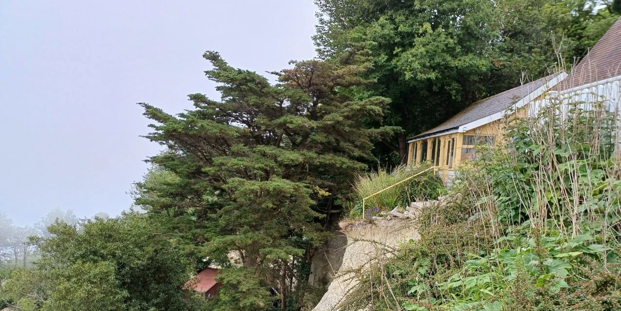
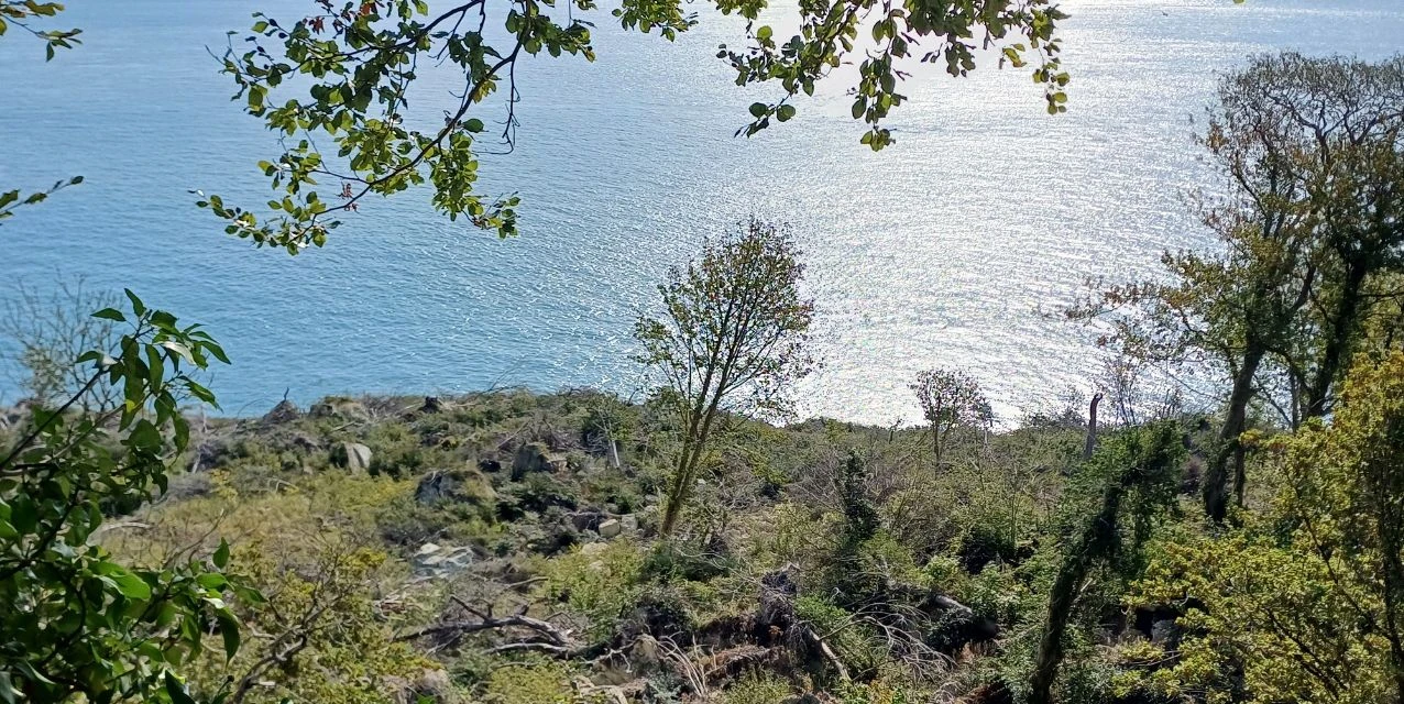
The Isle of Wight is known for its coastal landscapes and cliffs, which, especially along its southern coastline, can be particularly prone to landslides.
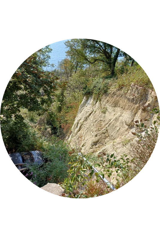
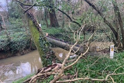
In December 2023, the upper section of Leeson Road was closed following one of the largest landslides ever recorded on the south coast of England. The incident saw 76 hectares, approximately 14 million cubic metres of land, displaced, which posed a significant threat to local infrastructure and residents.
The instability was attributed to a combination of factors, including toe erosion, where the base of the cliff that provided critical support to the land mass had been worn away, and extreme weather, as heavy winter rainfall led to elevated groundwater levels that further destabilised the geology.
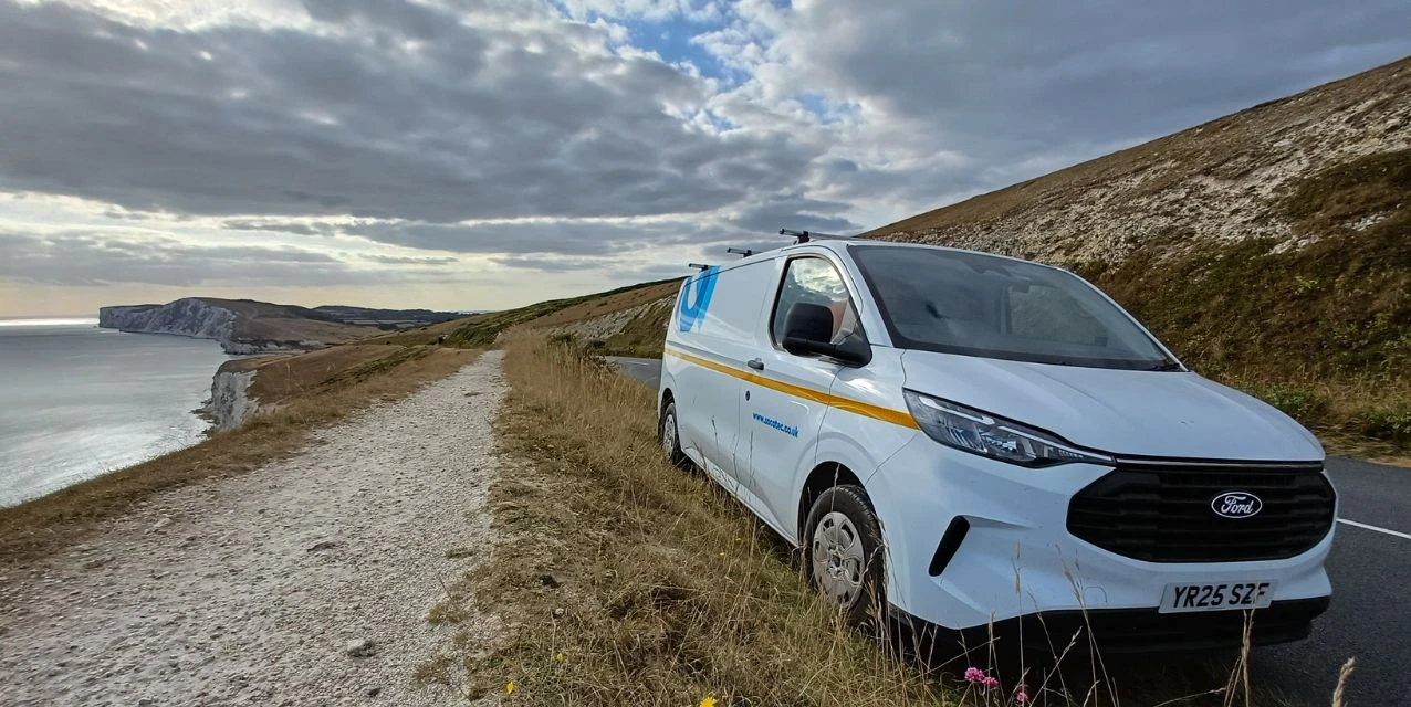
Given the scale of the movement and the continued environmental risks, a sophisticated remote monitoring solution was required to help ensure safety and guide long-term maintenance. Manual surveying was too risky and difficult in this hazardous coastal environment, necessitating an automated, continuous monitoring approach.
Project Description and Background
Following the initial landslide in December 2023, the Isle of Wight Council required a comprehensive monitoring system to track ground movement and provide early warnings in the hazardous coastal environment. The project aimed to ensure public safety while managing infrastructure with complete confidence.
The solution needed to provide comprehensive coverage of the affected area, detect subtle slope changes automatically, and deliver high-frequency, real-time data in a highly dynamic environment. The system had to operate reliably even during poor weather conditions and integrate seamlessly with monitoring software for a unified view of landslide behaviour.
SOCOTEC UK & Ireland was selected to deploy a high-resolution wireless monitoring system to track ground movement across the landslide area, ensuring continuous data availability while minimising the need for manual on-site inspections.

Solution
Solution
SOCOTEC UK & Ireland deployed a sophisticated, remote monitoring system, comprised of multiple integrated technologies:
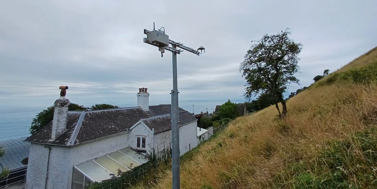
· Multiple high-precision Worldsensing GNSS Meters captured absolute 3D displacement with sub-centimetre accuracy, ensuring continuous monitoring even during poor weather conditions.
· These complemented the GNSS system by detecting subtle slope changes and automatically increasing sampling during critical events to capture detailed movement data.
· The deployment included the installation of a Piconode device with rain gauge and seven data loggers with varying inputs, Vibrating Wire, Analog and Digital, connected to extensometers, in-place inclinometers to a depth of 120m, and piezometer sensors.
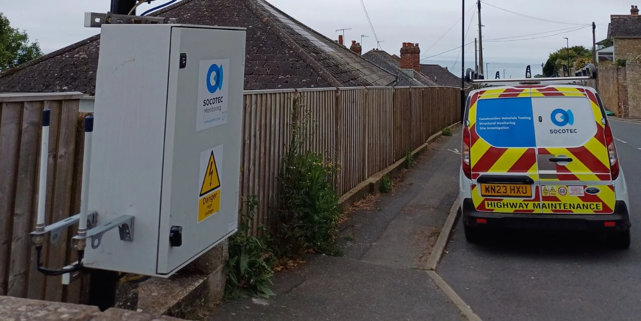
All sensor data was transmitted via long-range LoRaWAN to a centralised cloud platform, allowing engineers to monitor trends remotely, set automated alerts, and integrate the information seamlessly into SOCOTEC's software (Blue Trust Monitoring) for a unified view of the landslide behaviour.
Sheridan Elliott, Technical Director within Monitoring at SOCOTEC UK & Ireland, said: “Through the integrating of Worldsensing's GNSS Meters, and wireless Tiltmeters, IPI's, Piezometers and extensometers. This innovative, automated system delivers high-frequency, real-time data in a highly dynamic environment, giving the Isle of Wight Council the insights needed to manage public safety and infrastructure with complete confidence.”
SOCOTEC UK & Ireland deployed a sophisticated, remote monitoring system, comprised of multiple integrated technologies:
· Multiple high-precision Worldsensing GNSS Meters captured absolute 3D displacement with sub-centimetre accuracy, ensuring continuous monitoring even during poor weather conditions.
· These complemented the GNSS system by detecting subtle slope changes and automatically increasing sampling during critical events to capture detailed movement data.
· The deployment included the installation of a Piconode device with rain gauge and seven data loggers with varying inputs, Vibrating Wire, Analog and Digital, connected to extensometers, in-place inclinometers to a depth of 120m, and piezometer sensors.
All sensor data was transmitted via long-range LoRaWAN to a centralised cloud platform, allowing engineers to monitor trends remotely, set automated alerts, and integrate the information seamlessly into SOCOTEC's software (Blue Trust Monitoring) for a unified view of the landslide behaviour.
Sheridan Elliott, Technical Director within Monitoring at SOCOTEC UK & Ireland, said: “Through the integrating of Worldsensing's GNSS Meters, and wireless Tiltmeters, IPI's, Piezometers and extensometers. This innovative, automated system delivers high-frequency, real-time data in a highly dynamic environment, giving the Isle of Wight Council the insights needed to manage public safety and infrastructure with complete confidence.”
Conclusion
SOCOTEC’s implementation of the remote monitoring system brought significant improvements to managing the Leeson Road site.
The early warning capabilities of the site enabled the council to detect critical movements before they could escalate, while remote sensors reduced the need for manual on-site inspections, improving operational efficiency and minimising risk to personnel.
The monitoring system enabled residents to return to their properties, as well as allowing the opening of a high-dependency transport link connecting two main towns in the south of the island.
Continuous, real-time data streams increased confidence in decision-making when assessing the stability of the landslip area. The scalable deployment ensured long-term data availability and effective allocation of maintenance resources.
The successful deployment on the Isle of Wight highlights the value of digital innovation in proactive asset management. By integrating GNSS with tilt detection, SOCOTEC UK & Ireland and Worldsensing provided a robust framework for safeguarding infrastructure and managing the risks associated with dynamic coastal environments.
The project demonstrated how advanced monitoring technology can strengthen coastal landslide resilience, providing cost-effective, scalable solutions that ensure ongoing data availability for proactive maintenance and support infrastructure resilience by enabling data-driven interventions before failures occur.
Want to find out more...
Discover our latest News & Media

Fire Resistance: Everything you wanted to know but were afraid to ask

Nature Positive Real Estate: Creating Value through Biodiversity
UKTC opens multi-million-pound state-of-the-art second firehall

Infinito Delicias. Building low-carbon spaces for communities to thrive
Mass Data Capture in Modern Surveying