LiDAR Mapping Services for High-Resolution Surveys
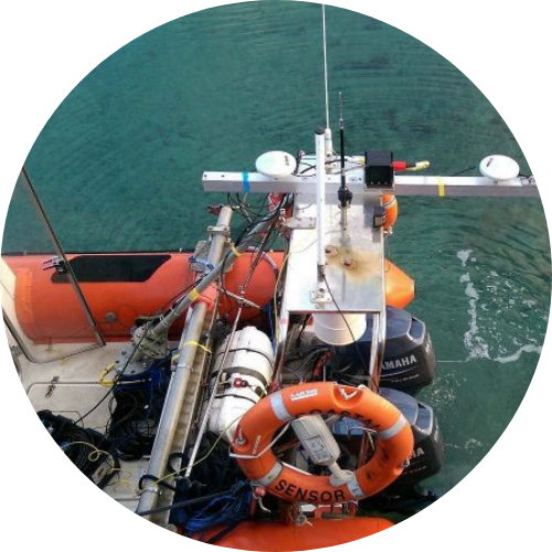
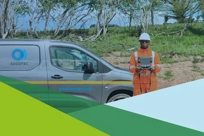
SOCOTEC operates UAV‑mounted, vehicle‑mounted and boat‑mounted LiDAR systems to collect high‑density survey data across the UK.
What is LiDAR Mapping?
LiDAR (Light Detection and Ranging) is a remote sensing method that uses laser pulses to measure distances and generate accurate three‑dimensional information on the landscape. SOCOTEC operates UAV‑mounted, vehicle‑mounted and boat‑mounted LiDAR systems to collect high‑density survey data across the UK. Our systems use high‑end Applanix GNSS inertial navigation units to ensure reliable positioning and orientation throughout each survey.
How It Works
LiDAR sensors emit rapid laser pulses and record the return time to calculate distance. These measurements are combined with GNSS positioning and INS motion data (roll, pitch and heading) to create georeferenced point clouds.
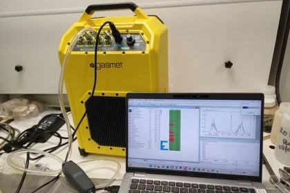
During each survey, RINEX GNSS files are recorded and processed within Applanix POSPac using Post‑Processed Kinematic (PPK) techniques. This resolves GNSS ambiguities and produces an SBET (Smoothed Best Estimate of Trajectory), which defines the exact position and movement of the platform. The SBET is then applied to the laser data to produce accurate 3D datasets.
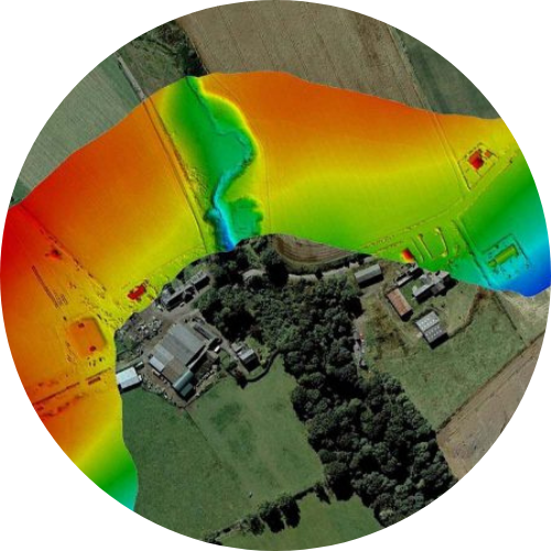
UAV LiDAR surveys typically operate at an altitude of around 40 m and a speed of 15 km/hr, capturing more than 300,000 points per second. LiDAR can penetrate tree canopies and vegetation, allowing the ground beneath to be mapped accurately. Our LiDAR systems can simultaneously record high-resolution imagery, which can be used to provide Orthomosaic maps, and colourise the point clouds.

LiDAR Surveys
Our Approach
SOCOTEC uses integrated UAV, road‑based and waterborne LiDAR platforms to suit different environments:
- UAV LiDAR – ±3 cm vertical accuracy. Used for forestry, heritage and difficult terrain.
- Vehicle‑mounted LiDAR – ±2–3 cm vertical accuracy. Used for highways, rail corridors and urban areas.
- Vessel‑mounted LiDAR – ±3–5 cm vertical accuracy. Used for rivers, canals and coastal sites.
All data is quality‑checked using independent check shots and processed to industry standards (ASPRS 2024).
Deliverables can be supplied for CAD, GIS and point‑cloud applications.
Equipment
Mobile mapping – Trimble MX50
UAV LiDAR – Riegl VUX-1, Velodyne HDL-32
Static Trimble - SX10
LiDAR Mapping
The Benefits
- High‑density data collection (200+ points/m²) in a single pass
- Faster than traditional survey methods, reducing time on site
- Operates in low‑light and complex environments
- Penetrates vegetation, enabling mapping beneath tree canopies
- Centimetre‑level accuracy when combined with GNSS/INS and PPK
- Reduced exposure to hazardous or hard‑to‑access areas
- LiDAR Data can be combined with underwater multibeam bathymetry to produce composite 3D models of marine assets.
Learn More about LiDAR Mapping
How does LiDAR mapping work?
Laser pulses measure distance. Combined with GNSS/INS and PPK processing, this produces accurate 3D spatial data.
Can LiDAR map through trees?
Yes. Multi‑return LiDAR can penetrate tree canopies and vegetation to reach the ground.
Where can I view free LiDAR data?
Environment Agency (England), DataMapWales (Wales) and the Scottish Remote Sensing Portal (Scotland).
Is there an online LiDAR viewer?
Houseprices.io and the National Library of Scotland both provide free LiDAR visualisation tools.

Discover our latest News & Media

Fire Resistance: Everything you wanted to know but were afraid to ask

Nature Positive Real Estate: Creating Value through Biodiversity

UKTC opens multi-million-pound state-of-the-art second firehall

Infinito Delicias. Building low-carbon spaces for communities to thrive
Mass Data Capture in Modern Surveying