Improving Ground Safety Through Monitoring of Carrickfergus Abandoned Mines
Northern Ireland’s Department for Economy has implemented a project to monitor the stability of the ground at three abandoned mine sites in Carrickfergus.
Presently, there is no perceived risk to the public at the trio of historically significant mining operations, at Maiden Mount, French Park and Duncrue, as the land at risk is fenced off as a safeguarding measure. The area within the fence has undergone collapse in the past, and is undergoing active subsidence. This project will establish whether any risk exists outside the fence.
With mining operations dating back to the 1850s and involving room & pillar and solution mining methods, the sites presented complex geological challenges which required comprehensive monitoring to assess long-term ground motion patterns.
Project Background and Description
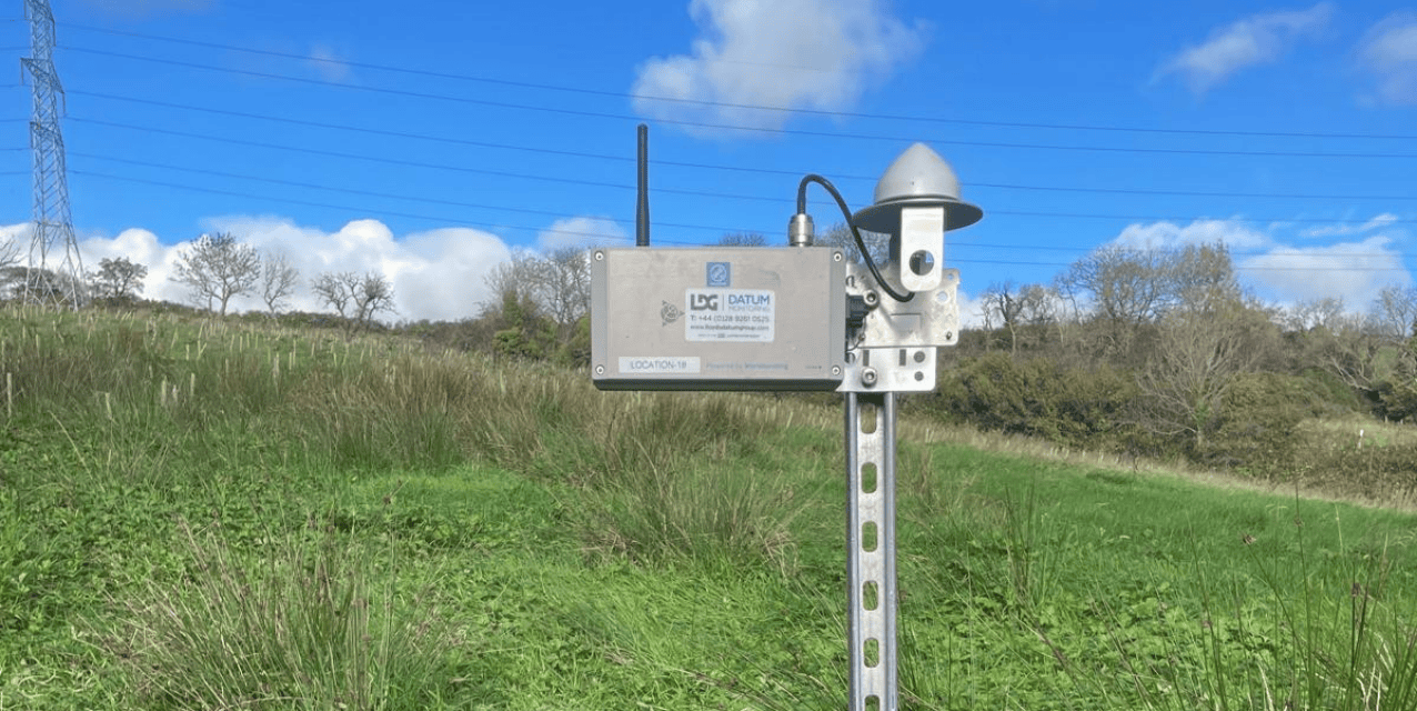
Datum Monitoring Ireland Ltd t/a LDG Datum have been brought in to assist with the project, implementing a thorough monitoring network to establish whether there are any ground motions “movement” across the site and to what extent.
The mines themselves all present unique challenges:
- Maiden Mount Mine: operated from 1869-1958, reaching depths of 274-278m, with current void heights of 33m
- French Park Mine: operated from 1870-1952, at 203m depth with 28m void heights
- Duncrue Mine: operated from 1853-1938, at 180m depth with unknown current void conditions
Each site features significant underground voids created through decades of extraction, with dimensions ranging from 175m x 180m to 240m x 230m. The project scope has established a comprehensive two-year monitoring programme, in order to provide the Department for Economy with essential data on ground motion behaviour at these abandoned mining locations.
Solution
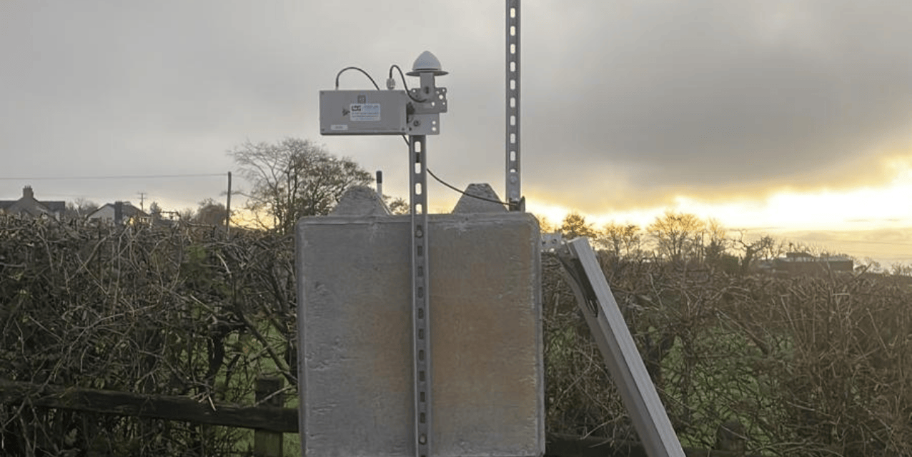
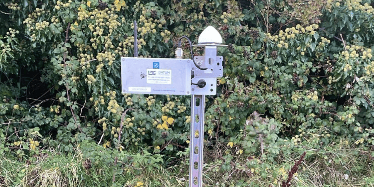
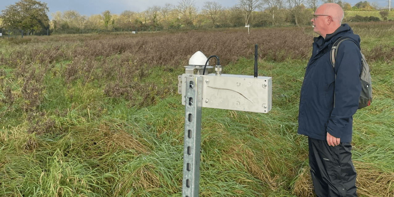
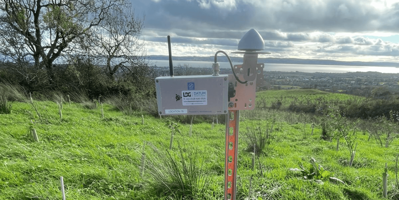
To achieve this outcome, LDG Datum has implemented an advanced Global Navigation Satellite System (GNSS) based monitoring solution, which includes the deployment of sensors strategically positioned across the three mine sites and wider area.
There was a further central online gateway system that enabled data collection and transmission, as well as a solar panel system for ensuring autonomous, continuous power throughout the project’s lifecycle.
Real-time ground movement is detected to millimetre-level precision, while the remote monitoring capabilities of the technology used, ensured that there was minimal site access requirements. This project is scheduled for two years, aimed at collecting the long-term data tracking that was possible made for very detailed trend analysis, providing a better quality of result for the client. And, finally, the project utilised a self-sustaining power infrastructure, used for remote locations, such as the mines themselves.
Conclusion
Over time, the monitoring programme will establish if there is any ground movement, giving the Department for Economy essential ground motion data for evidence-based decision-making regarding land use planning and potential remediation strategies.
The deployment of precision GNSS technology by LDG Datum will enable the continuous assessment of subsidence risks, all while supporting the development of a long-term strategy for abandoned mine management in Northern Ireland.
The value of providing ongoing surveillance of these historically significant but potentially hazardous sites, contributing to enhanced public safety and informed infrastructure planning decisions.
Want to discover more about our services?
Discover our latest news & media

Fire Resistance: Everything you wanted to know but were afraid to ask

Nature Positive Real Estate: Creating Value through Biodiversity
UKTC opens multi-million-pound state-of-the-art second firehall

Infinito Delicias. Building low-carbon spaces for communities to thrive

Mass Data Capture in Modern Surveying